

In late July Gilbert Roe and myself had a 5 day camp at Lake Lascelles in Hopetoun, which is in the northern western part of the Wimmera Mallee in Victoria . It was a winter camp and it was very cold at night with sub zero temperatures in the early morning. On the last morning of the camp there was heavy fog in Hopetoun, which meant a midday departure, since the tent’s fly need to dry before it was packed away.
It was a fruitful trip despite a lack of photos being taken. The details of the second exhibition of the Mallee Routes project at Swan Hill Regional Galley in March 2018 was sorted with Ian Tulley, the Director of the Gallery, in that the large gallery space will host two exhibitions: one by Paul Oswin’s bird drawings and the other showing the photos from the Mallee Routes project. Secondly, we made contact with the ACRE project, even though I have yet to figure out how a documentary style photography can be a part of this ongoing regional project.
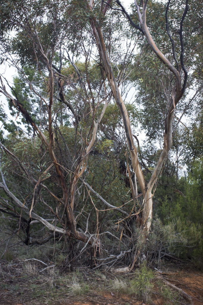
The other reason for it being a fruitful road trip was that though my extensive scoping– several days spent driving along both the Henty and Sunraysia Highways from Swan Hill to Horsham and return — uncovered new subject matter beyond agricultural fields with solitary trees, silos and rundown, decaying buildings. It was water, or rather the lack of it, in the form of dried up creeks such as the Yarriambiack Creek and the low levels of the rivers, such as the Wimmera. This take me beyond my first cut at water, namely photographing the various water towers.
The Yarriambiack Creek flows north from the Wimmera River just east of Horsham, and it drains into Lake Coorong in Hopetoun. Both the Yarriambiack Creek and Lake Coorong were bone dry this winter. They would be suitable subject matter for a future trip that looked at the streams and wetlands, say around Antwerp and Jeparit. Surprisingly, there are a large number of wetlands in this dryland region, most of which are on private land and are ephemeral. A number of the region’s wetlands such as Pink Lake, Natimuk Lake, Oliver’s Lake and White Lake are ecologically of national significance, whilst Lake Albacutya is a wetland of international significance.
The old water tower infrastructure, which was built to counter the ephemerality of the rivers and lakes in the drylands of the Wimmera Mallee, is being left to decay.Water to the various towns in the Wimmera Mallee is now provided by the Wimmera Mallee Pipeline since 2010, and this replaced the extensive network of open, earthen channels of the old Wimmera Mallee channel system that was built in the 20th century from 1906 to 1967. The pipeline, which aims to provide a reliable, quality water supply, draws its water from the Grampians and the inland Wimmera River, whose overall ecosystem health is poor.
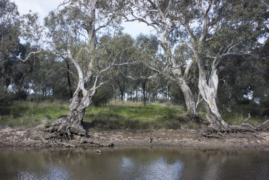
The Wimmera River rises in the Pyranees Ranges near Ararat and the lower Wimmera River (ie., the section of river downstream from Horsham to Lake Hindmarsh ) is of high ecological value, yet is highly stressed and regarded as degraded with both poor water quality, the clearing of native riparian vegetation and high salinity caused by low flows and the intrusion of groundwater. It is the reduced flow that is driving poor water quality of the river. During dry periods the river becomes a series of pools. I didn’t see the Wimmera River near Horsham as a romantic, mysterious place when I walked along its banks. What I saw was not a river of of Red Gums, dreamy sunsets and tranquil stretches of water—rather, they were more akin to stark images of dead trees, emblematic of a dying river.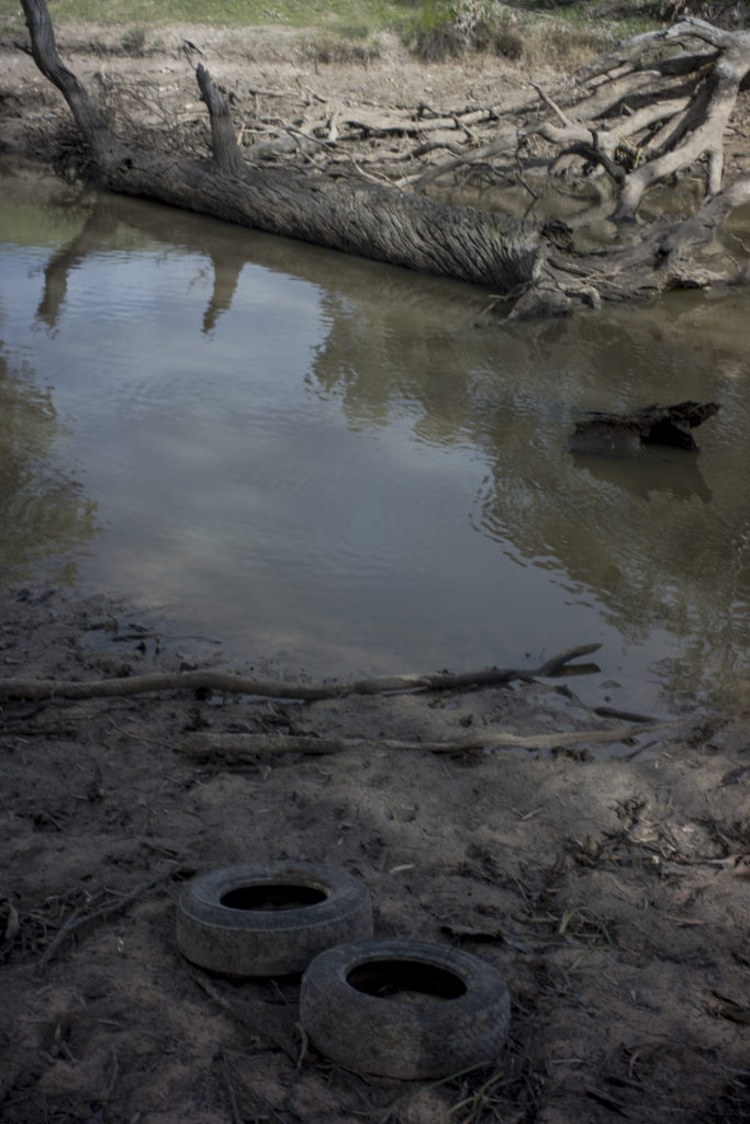
Since 1840, clearing, grazing, erosion, run-off from agriculture and other polluting industries, combined with dams built through the Grampians section of its upper catchment and rising water use had all contributed to the decline of the Wimmera River. The decade long drought in the 21st century worsened its plight caused by the ongoing economic exploitation of water and land–improving nature for the settlers. Their’s was a confident, expansionist, human-oriented view of the possibilities created by controlling nature. In this vision, water was initially perceived as an unlimited resource, which would allow people to challenge climatic limitations imposed by nature–the engineering dream was to ‘drought-proof’ the Wimmera-Mallee.
[…] came down with a severe cold at the end of the July Mallee roadtrip and this, coupled with the wet stormy weather, has meant minimal poodle walking and limited local […]
[…] briefly explored in and around Birchip during the Hopetoun photo camp in July, looking for material for a large format photoshoot. Birchip is in […]
[…] have previously written about water and the Mallee in previous posts— here and here and here. The history of water in the early 20th century in these posts was one of supplying […]
[…] in 2021. I stayed over night at Lake Lascelles in Hopetoun for a photo session the next day. I had stayed there in 2017 in the early collaborative stages of the Mallee Routes project; a stage that has since […]