

Below is a review of Mallee Routes: Photographing the Mallee 2019 by Doug Spowart. Doug runs the fascinating and very informative wotwedid blog with Victoria Cooper and works at the Centre for Regional Arts Practice.
For a photographer the ‘calling’ to photograph certain issues, themes and subject matter can take the form of a persistent and thorough investigation taking years to yield a body a work. That work is usually destined to being communicated publically through an exhibition in a gallery, an essay in a magazine, a book or in a blog post. All photographers’ presentations are loaded with their manifesto, a call to action or a powerful argument to persuade the viewer to see things the way the photographer does in order to create change in the world order.
For some time the South Australian photographer Gary Sauer-Thompson has been drawn to document the geographical space overlapping the border country of south-western NSW, north-western Victoria and eastern South Australia known as the Mallee. Now he presents the outcome of his investigation in the form of a physical book that is an extension of an associated group exhibition. While Sauer-Thompson may have a specific expectation for the communiqué that the book is meant to deliver, it could be reasonable to ask what will be triggered in the reader’s mind as they ponder the photographs before them and turn each page to the next and the next.
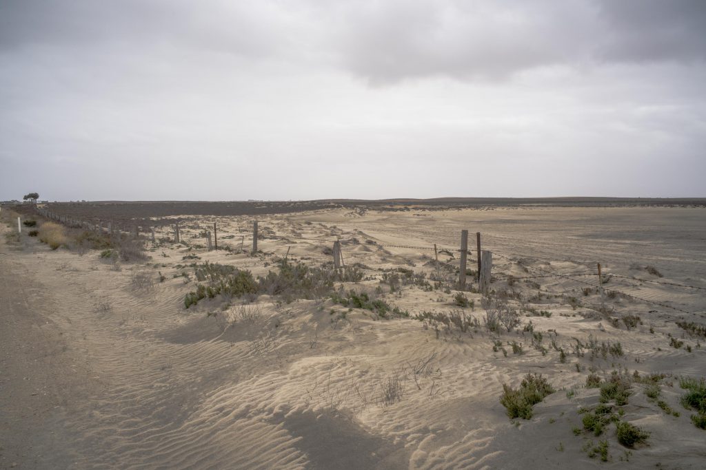
The Mallee country is an arid expanse of sand dunes, stunted eucalypts bisected by the channelled flows of the Murray, Darling and Wimmera Rivers. In pre-colonial times Aboriginal people lived in unison with the land and its seasons for tens of thousands of years.
Colonial settlers thought that by clearing the land and pumping water from the rivers and bores they could convert the arid land into one that could be commercially viable. The First Peoples were displaced; the land surveyed and settled in varying stages of development reliant on government schemes and access to railway and transportation systems for the produce created.
In stages the land gave up its canopy of trees – the roots dug up for firewood and the plough and the irrigation channel brought about successful farming ventures of orchards, wheat field and grazing land. Over 100 or more years the agrarian story oscillated from success when water was available to failure when the land was affected by persistent drought cycles, associated reduced river flows, the creeping scourge of rising salt (caused by land clearing) and the loss of top soils.
For a moment I ponder on thoughts of my connection with, and understanding of this region – then hold the Mallee Routes book in my hands. I feel the surface of its smooth white cover and I open the book and encounter its content. In this first reading I chose not to read the foreword as I have an interest in the photographs and the communiqué that they can impart. What I am looking for in this initial connection with the book is an encounter with a narrative. This is usually revealed through the considered way in which the author/designer sequences words or images or both in the design of the book to present, through the turning of pages.
[…] On a recent visit to Melbourne I decided to go the long way — along the Mallee Highyway to Ouyen and then along the Calder Highway to Castlemaine. I camped overnight at Walpeup on the Mallee Highway and then at Castlemaine before driving onto Sunshine in Melbourne. This round about way of travelling provided me with an opportunity to photograph in the Victorian mallee. I wanted to kick start working on the next Mallee Routes photobook. […]