

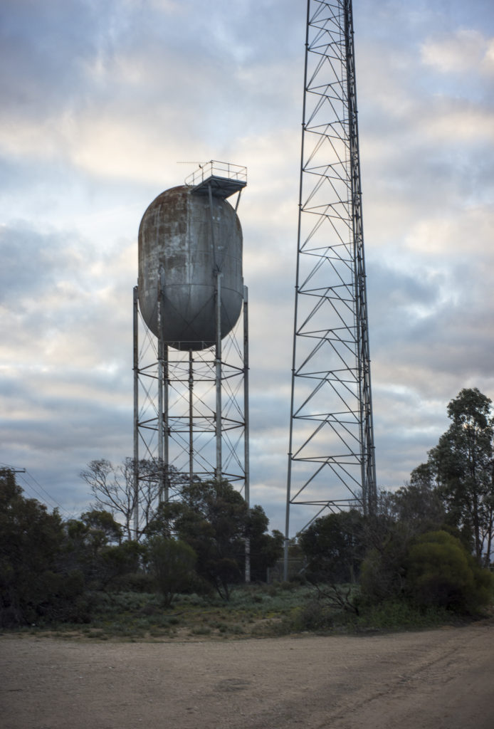
Although it is the grain silos along the old railway lines that dominate the landscape in the Mallee, the odd-looking, elevated water-towers in the various towns also stand out. These water towers suggest that water is scarce in the Mallee, and that it needs to be either piped in from a river, or drawn from the underground aquifers. Even though the Mallee lacks water due to the low rainfall and no rivers, and is is a dry country prone to drought and dust storms, the development of the Mallee through agriculture were deemed to be the key to economic growth.
If the Mallee was to be a prosperous and cheerful place to live in, with the small wheatlands settlements being the nucleus of community life, then the country needed water. The photo below is an example of an elevated water tower in Karoonda, South Australia. I assume that water is pumped into the tower from some form of earthen storage:
The initial form of water infrastructure in the Mallee was bore water, sourced from drawing from the ground water in the various acquifer systems underlying the Mallee. The main aquifer system is the vast underground artesian basin in which the water from the Grampians filters through the underground coral acquirers as it flows toward the River Murray. A line of bores powered by windmills was put down from Underbool to the South Australian border by the Victorian government prior to World War 1, and the increase in water supply, along with the rail link from Tailem Bend to Ouyen, enabled the rapid settlement of the Mallee. This largely took the form of small blocks.
The next step in the Mallee’s publicly built water infrastructure was the open, earthen channel system, known as the Dennying Channel, was a stock water supply and irrigation infrastructure that ran from the Grampians ranges south of Horsham, north beyond Ouyen to Manangatang in the northern Mallee. It was 17,500 kilometres long and it delivered water to storage dams across the Victorian Mallee. The water was extracted from the Wimmera River but the channel was inefficient means of transporting water, due to silt, weeds, drift sand and high levels of seepage and evaporation. Up to 90 percent of the water extracted from the Wimmera River was lost through evaporation and seepage.
The most kind of water infrastructure is an extensive network of pipelines. The first network to be constructed was the Northern Mallee Pipeline (NMPP), which was built between 1992 and 20o2. It takes water comes the Murray River to supply towns in Victoria’s northern Mallee region boarded by Ultima, Sea lake, Inderbool, Wemen, Kooloonong and the Murray River. The southern part of the Dennying channel in the Victorian Mallee was then replaced by the Wimmera Mallee Pipeline in the first decade of the 21st century (completed in 2008), with the water taken from The Grampians headwaters.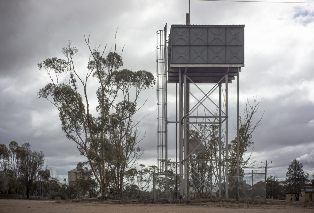
Despite the shortage of watering The Mallee, there appears to be limited investment to recycle water in the towns. The public investment continues to be on extending the pipelines throughout the region to support agricultural expansion and on mining the ground water to grow potatoes, onions, pistachios and olives. The obvious danger is the risk of overdevelopment, not just in the traditional form of over-grazing and over-cropping, but in over using the ground water and over extracting the water from the rivers. The risk is one of using the water resources beyond their capacity to replenish themselves.
In the realist aesthetic tradition photography needs a world of objects to be seen, but the aquifers and underground pipelines are beyond the realm of the visible—they are invisible to the realist photographer. So we have gaps between sensing, making sense of, framing and persuasion. Another example go what is invisible to the realist photographer is how the large scale clearing of the perennial, deep rooted native vegetation in the Mallee in order to grow shallow-rooted cereal crops has contributed to the increase in salt discharge into the Murray and Wimmera rivers.
Whilst researching material for this post I came across very little photography in the British colonial states of the Mallee before the great clearing in the early 20th century to develop the land. The colonial photography, which was designed to record and legitimise the value of the colonial effort in South Australia, did not represent 19th century pastoralism in the Mallee. This absence in the archives of the state archives means that we start with the historical photographs of settler capitalism’s agriculture development in the early 20th century. The images of this settlement were made by those living on land, and they usually take the form of photographs of the smallholder settlers in the wheat growing districts struggling to conquer the land, establish their farmland and civilise the Bush.
These struggles were in marked contrast to the rural ideal of a green, well-watered countryside of farms and villages that has helped to shape European thinking about the Australian continent for more than two hundred years. Making the brown’ and ‘sunburnt’, sparse and sprawling, ‘bush’ into ‘countryside’ was what colonial Australians often aspired to do. Country Life was deemed to have moral superiority over city life. This was still the case after 1945. B.A. Santamaria and his Catholic Rural Movement contended that Country Life was better, physically, socially and morally, than city life; and that some of its virtues derived from the farmer’s arduous struggle to conquer and dominate nature. For most of the 20th century politicians believed that country life was a national good that should be supported by the taxpayer, that the state could promote and strengthen this mode of life, and that agriculture expansion was central to the economic and emotional revitalisation of the nation.
All that changed in the 1970s with the emergence of a neo-liberal of governance in Australia.
[…] The other reason for it being a fruitful road trip was that though my extensive scoping– several days spent driving along both the Henty and Sunraysia Highways from Swan Hill to Horsham and return — uncovered new subject matter beyond agricultural fields with solitary trees, silos and rundown, decaying buildings. It was water, or rather the lack of it, in the form of dried up creeks such as the Yarriambiack Creek and the low levels of the rivers, such as the Wimmera. This take me beyond my first cut at water, namely photographing the various water towers. […]
[…] have previously written about water and the Mallee in previous posts— here and here and here. The history of water in the early 20th century in these posts was one of supplying water to the […]