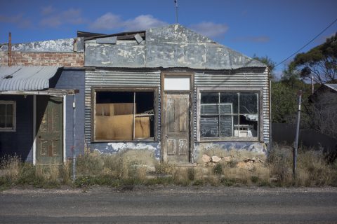
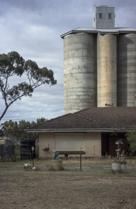
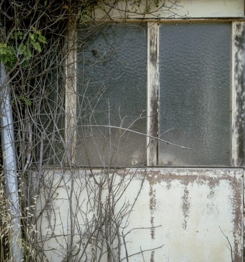
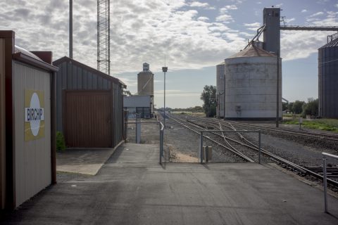
ruins
The photos in this post were made whilst I was on my way to photograph the silos at Linga. The location of these ruins is Torrita on the Mallee Highway in Victoria. Normally, Torrita is a place that you drive through. However, I was early for the afternoon photo shoot, so I decided to spend some time wandering around this hollowed-out hamlet in the Victorian Mallee. Was this photographic ruin gazing– what has recently become known as ruin porn?
Torrita is almost a ghost town: all the houses and shops, bar one house, stand empty. The tennis court was in ruins as well. They have lost their functionality and meaning in the present. It is no longer a place that could be called home. These kind of traces of the past signify that an era in Australia’s agriculture modernity has come to a close as well as giving us a sense of historical rupture. These kind of crumbing fragments of architectural ruin expose ourselves to the shock of experience, rather than evoking the heritage industry’s nostalgia for the past. These kind of ruins in the Mallee are not going to be preserved or restored; or torn down and recycled, to be replaced with something newer and more contemporary. They are detritus. So is Torrita.
Yet these ruins are reminders. They make us think of the past—the Mallee as a land of promise in the beginning of the 20th century after the failure of pastoralism in the 19th century; then the bust in the 1980s with the collapse of sheep, wool and wheat prices. The decaying and empty houses in the dying small towns, which is one of the most obvious features of the Mallee in South Australia and Victoria, remind us that the agricultural boom of the 1950s/1960s was over. A consequence is the de-population of the inland countryside that started in the late 20th century around the 1980s with the downturn in the rural economy and the withdrawal of government services.
The ongoing de-population is caused by the restructuring of farm production, due to the concentration of small farms into to larger and fewer agricultural properties, an ageing population and young people moving to the larger regional centres or to the capital cities to acquire an education and find employment.
Read More
Dust storm
In the autumn of 2016 I encountered a dust storm whilst I was camping at Ouyen with Gilbert Roe for several days in order to make some large format, black and white photographs of the silos along the Mallee Highway. These were for the Weltraum exhibition at the Magpie Springs gallery; a group exhibition that was a part of the small 2016 Shimmer Photographic Biennale. This is South Australia’s only photographic biennale, and it is organised and supported by the Onkaparinga Council.
After an early morning silo photoshoot at Galeh I spent the day travelling along the Mallee Highway from Ouyen to Piangil in the Victorian Mallee. Piangil is the northern end point of the Mallee Highway, and it is just south of the Murray Valley Highway, the River Murray, and Tooleybuc in NSW. Whilst returning to the Ouyen camp around lunch time I encountered a dust storm sweeping across the sun drenched agricultural landscape from the south west.
I stopped along the highway and took a number of snaps of the dust storm with my digital camera. This is one of them:
I didn’t dare use my large format cameras to photograph the dust storm because the swirling dust was too great and the wind was far too strong. The dust storm gave way to rain that night and to overcast conditions the next day. Normally, it is very bright and sunny in the Mallee. The dry, flat landscape is sun drenched. Read More
the first step
The beginnings of the Mallee Routes project emerges from this post on Gary’s thoughtfactory website. It shows firstly, that Gary’s contribution to the project is an outgrowth, or a spin off, from his silo project on the Mallee Highway; and secondly, that Gary has connected with two other photographers–Gilbert Roe and Eric Algra–who have been photographing the Mallee independently, to form a collaborative project.
The title of the project–Mallee Routes– was suggested by Eric Algra. In coming together to work on a collaborative project the three photographers will be working from diverse perspectives, and with different interests and various approaches to their photography. We reckon that the time frame of the Mallee Routes project is about three years, and that it will primarily concentrate on the South Australian and Victorian Mallee. The NSW Mallee near Lake Mungo is probably outside the project’s boundaries. The project’s website was constructed by Chris Dearden, whilst the website’s blog is about the process of the project. The blog may, or may not, become a co-operative one.
One notable aspect of the Mallee in the Murray-Darling Basin is that, apart from the various national parks, it primarily consists of agricultural landscapes, small towns, and minimal, scrappy native vegetation along the side of the roads.
I find photographing the Mallee scrub difficult synthroid 25 mcg. This scoping attempt, with a digital camera, was made whilst I was travelling on the Kulkami Rd between Lameroo and Karoonda after a silo photoshoot at Lameroo. The location of this scrub was around Kulkami near the Marama turnoff, which is approximately half way between the Lameroo and Karoonda townships in South Australia. Read More